Five miles south of the Canadian Border, and twelve miles west of the Washington-Idaho state line lies the town of Twin Peaks. The iconic show was shot in and around Snoqualmie Valley, so we couldn't resist making a variant with locations from the show and movie.
Since the layout of the fictional town doesn't quite match the real world topography, we balanced labeling based on real life shooting locations and logical placement based on references in the show. If you're looking for a map of the real Snoqualmie Valley, we have that too.
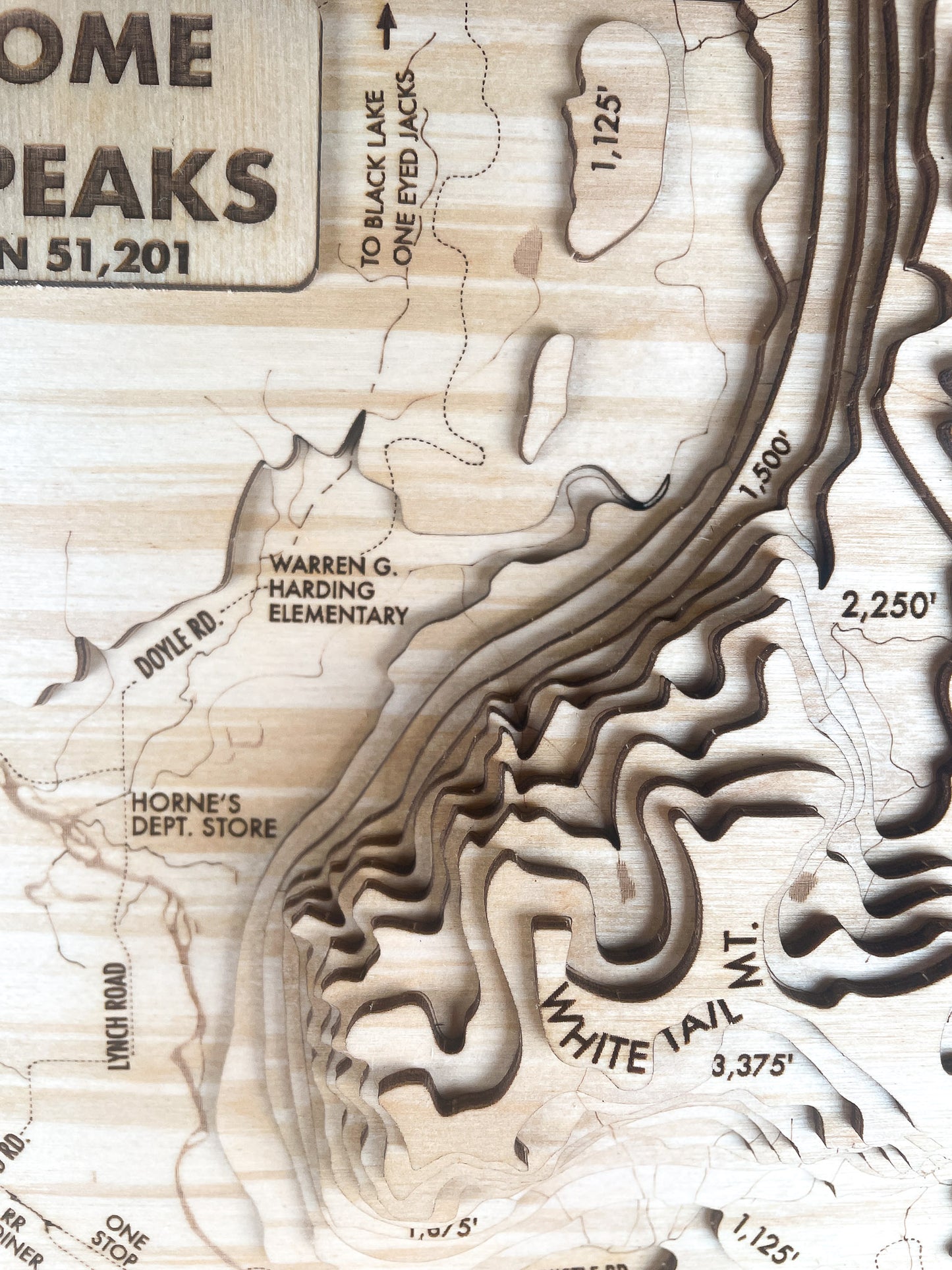
Mapped at a scale of 1:51,987, this model captures an elevation range of 375–4,500 ft, with each layer of plywood representing 375 ft of real-world elevation — scaled up approximately 1.4x vertically to emphasize ridges and valleys.