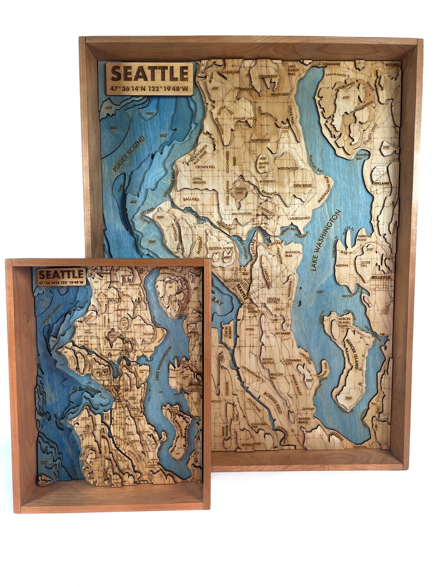
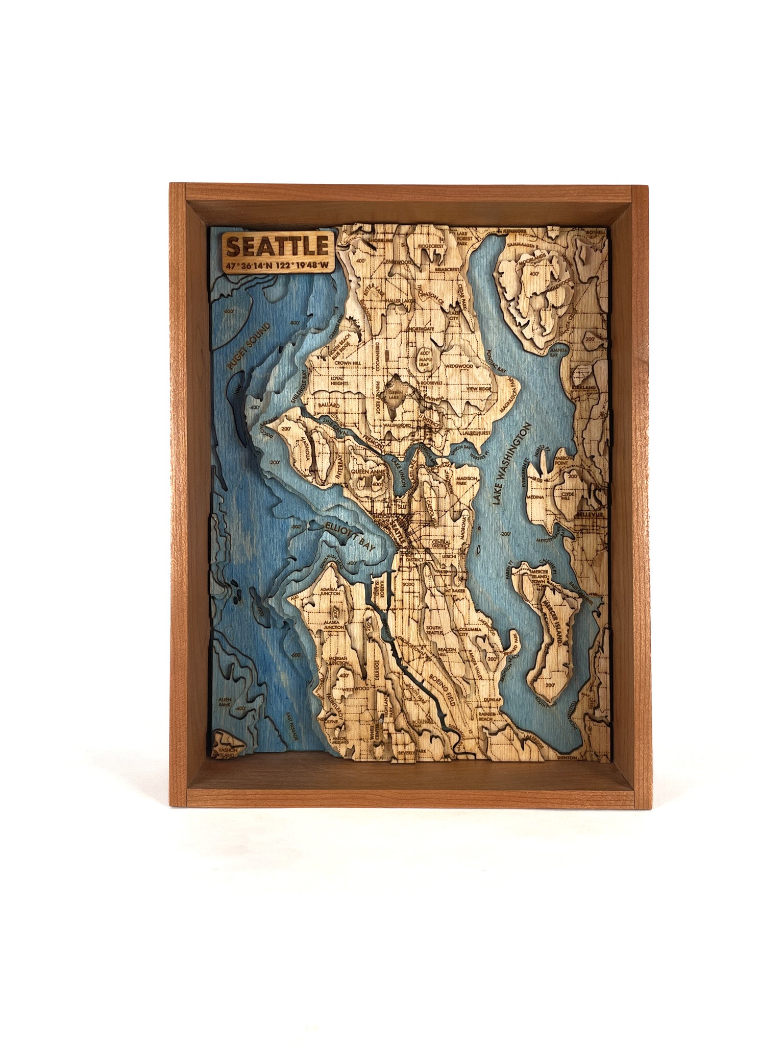
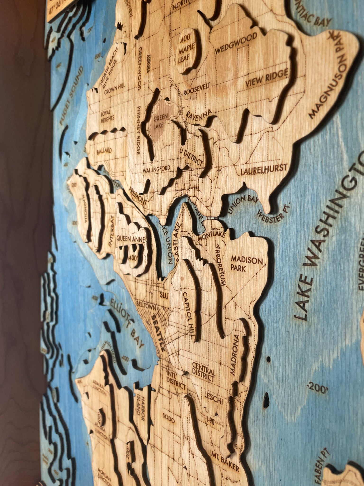
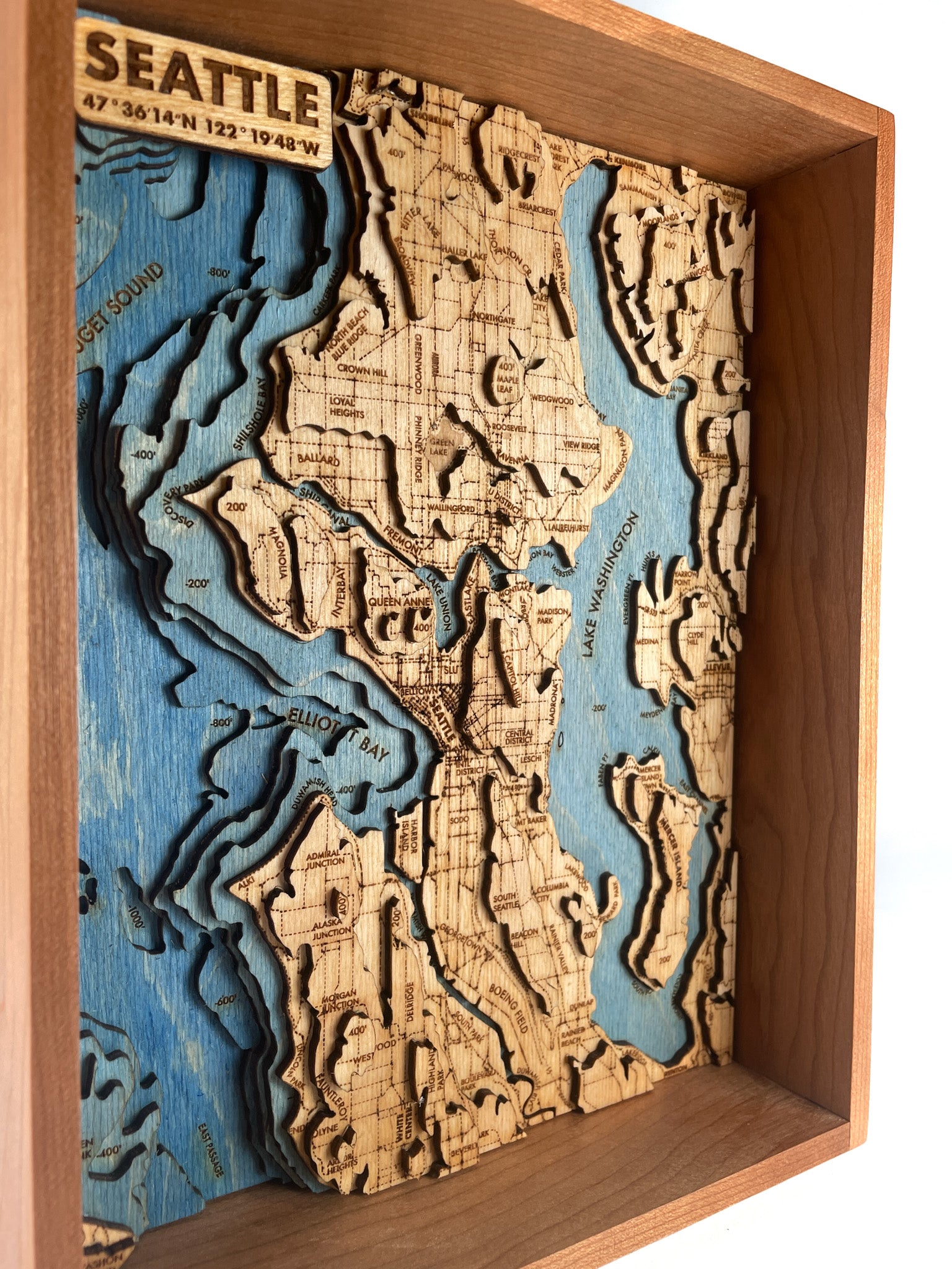
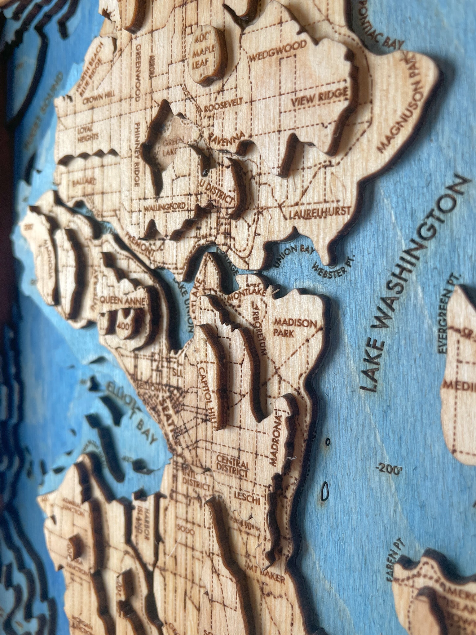
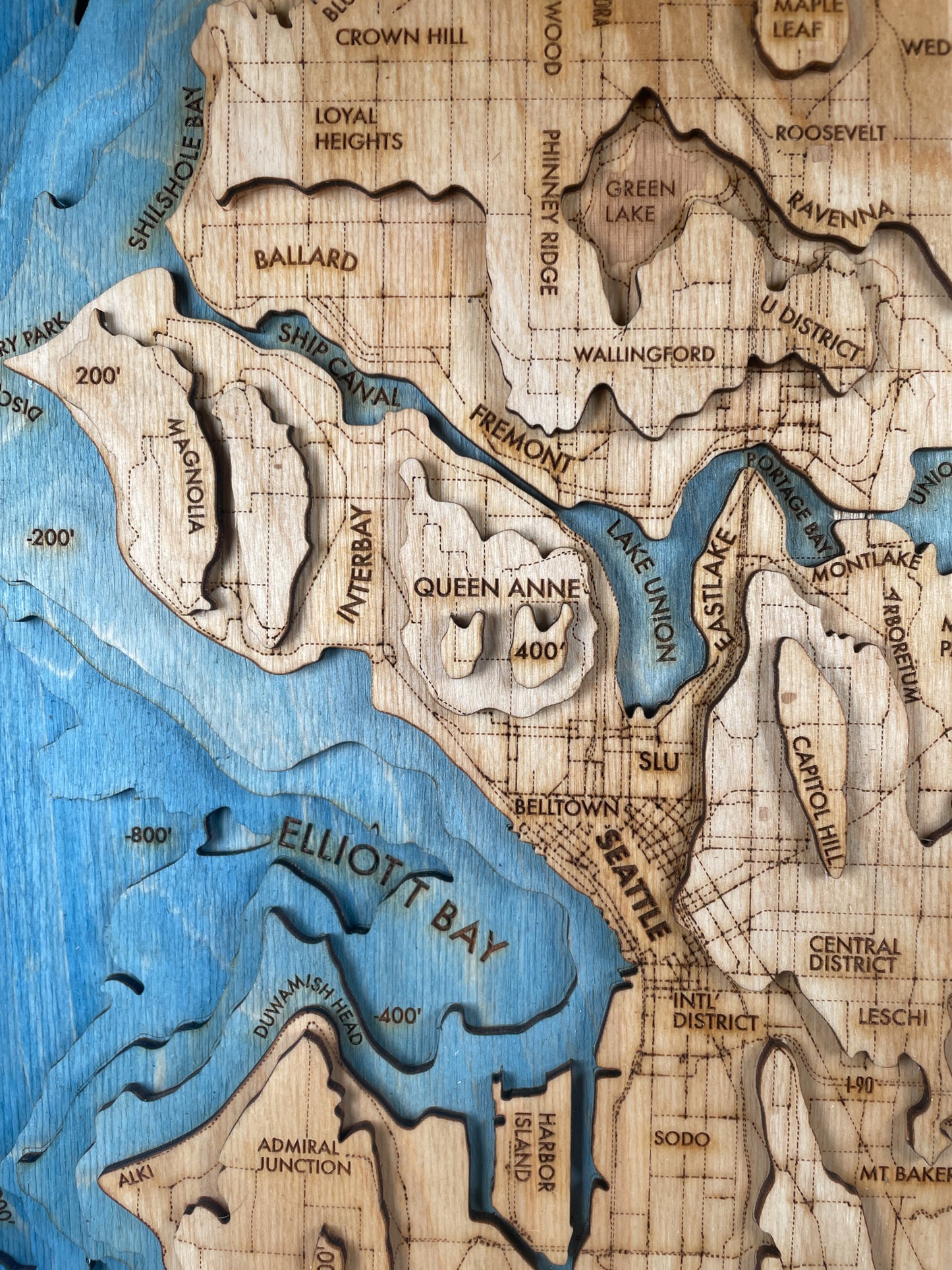
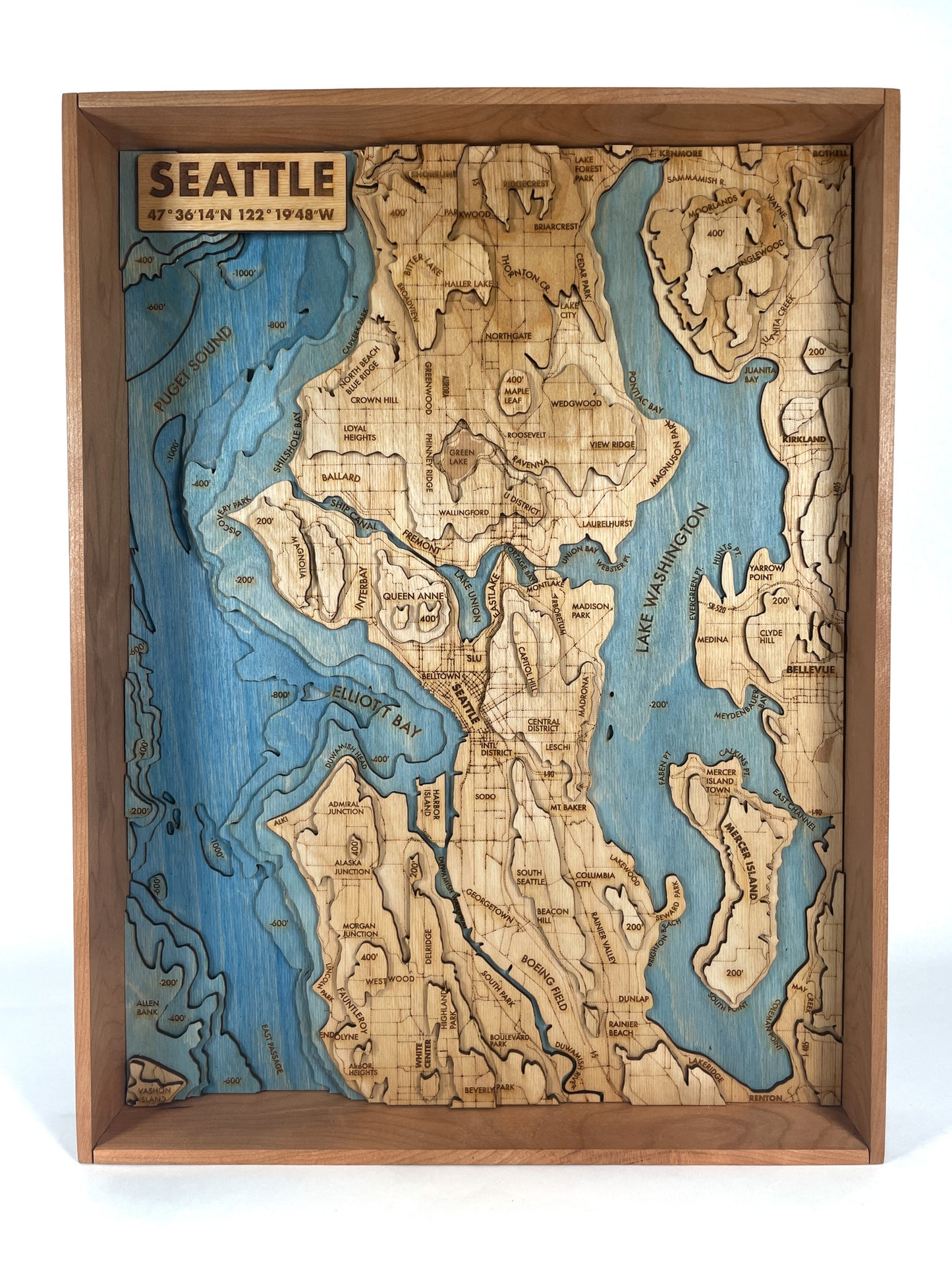
Seattle is a pretty hilly town. And this map has plenty of those to go around. But turns out the really steep stuff is just offshore in Elliott Bay and Puget Sound. It's probably why the world's largest octopus can be found there, and why Seattle makes such a perfect port.
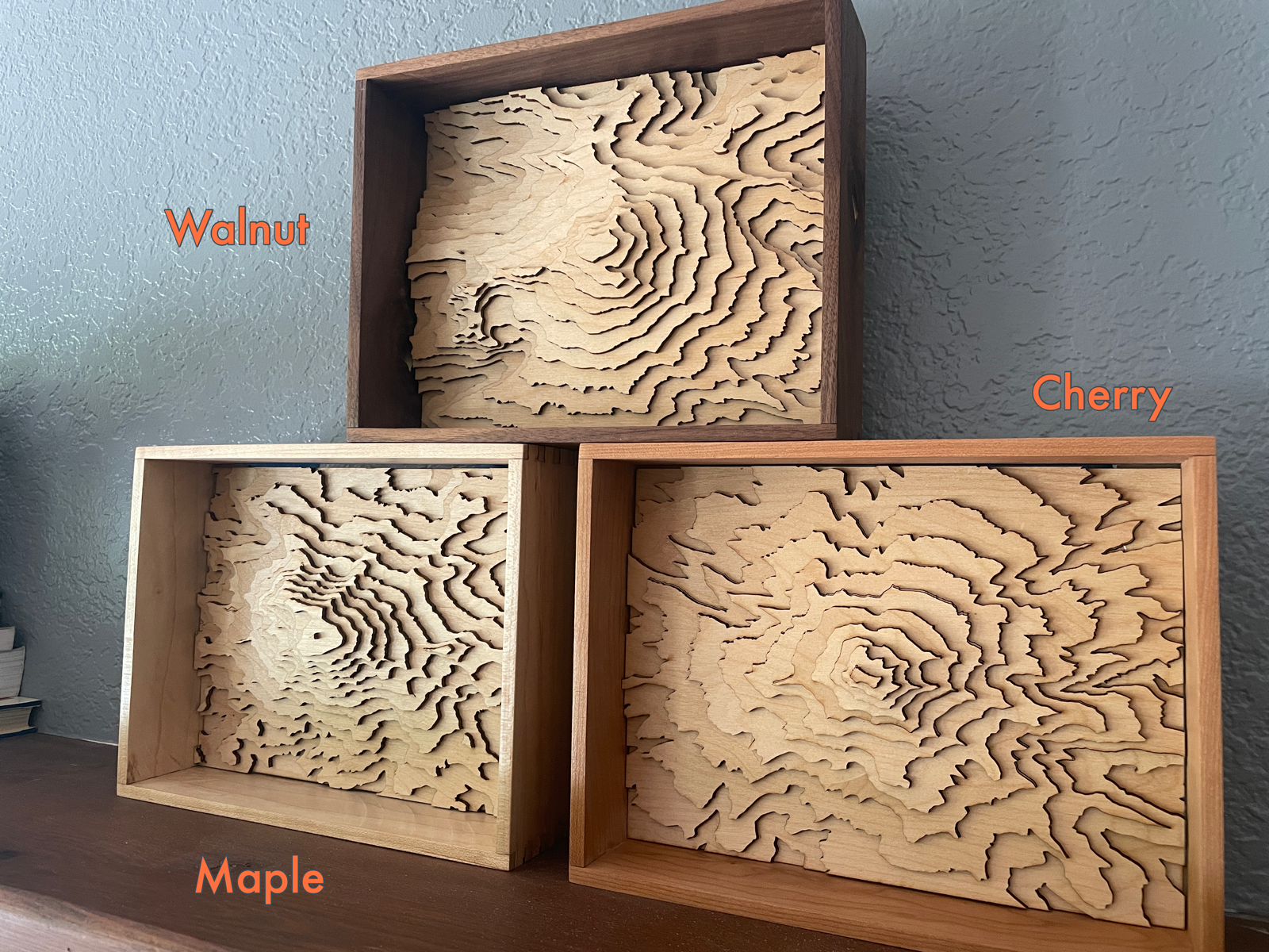
Seattle was home for a big part of my life so it was important for me to get the details just right. Major roadways, streams, and waterbodies are all represented, with Lake Washington and Puget Sound represented in a gradient of blue dyed layers to emphasize the depth.
Each layer of the map represents 200 of vertical elevation, including 1000' of depth and 400' of elevation above ground.